
Using Satellite Imagery and Deep Learning to Evaluate Canadian Environmental Governance
Canadian Political Science Association Conference (2026)
Abstract
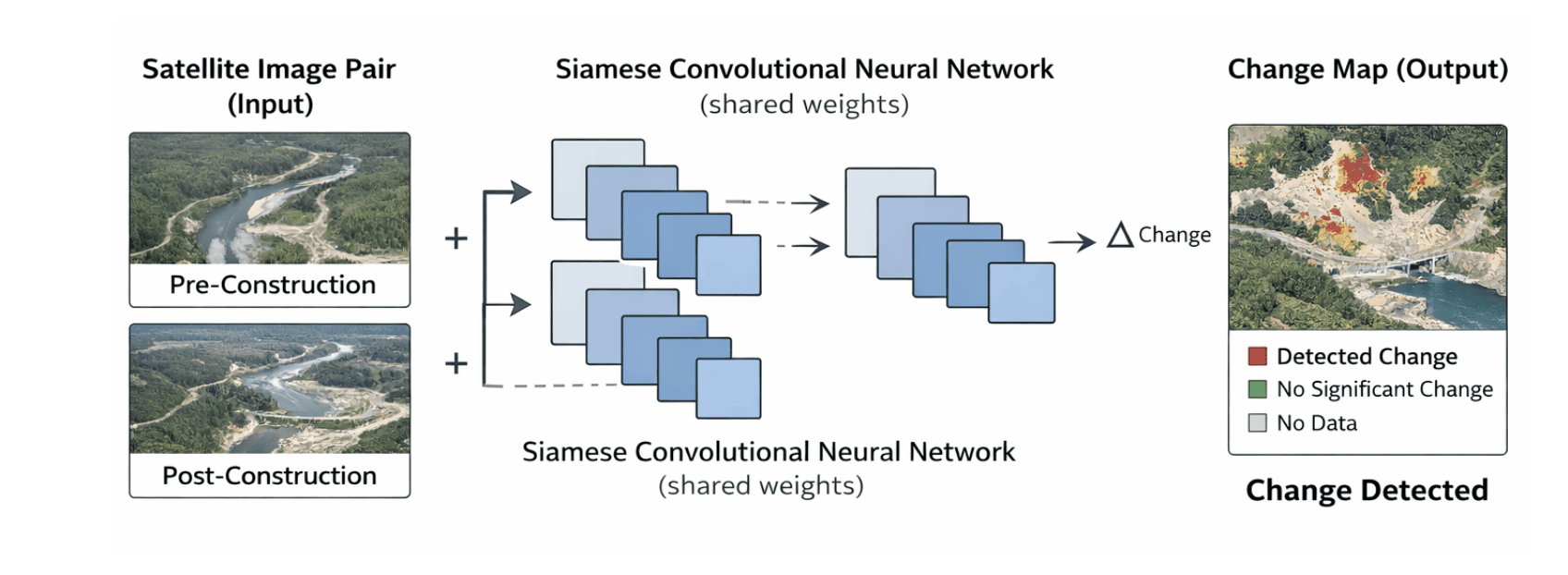
Large-scale development projects in Canada have transformed landscapes in ways that often escape public view—with many sites deliberately and systematically shielded from visibility. Forests are cleared, rivers are dammed, and ecosystems are reshaped under claims of economic necessity and sustainability. This paper examines how such environmental change becomes visible and politically meaningful through a mixed-method approach. Using the Site C Dam in British Columbia as a case study, we develop a convolutional neural network (CNN) trained on satellite imagery to identify and visualize environmental degradation, and link those results to the institutional and policy factors that may have caused it.
We combine computational image analysis with document review of environmental assessments, consultation records, and policy reports to explore how accountability and oversight operate within Canada’s system of environmental governance. Building on the social vulnerability work of Rufat et al. (2015), our analysis considers how environmental change and governance decisions can produce unequal impacts, particularly for Indigenous and low-income communities. The project contributes to research on environmental governance by integrating machine learning with policy analysis to evaluate how visibility, accountability, and institutional design interact in Canadian environmental decision-making.
Authors
Kira Jensen, Mike Cowan, Alan Wei, Christopher Greenaway, Christopher Cochrane
Copyright © 2026 – PATRON-ROTIP